
our core services
Site Investigations And Reporting
Proof Roling of Geotechnical Design
Proof Roling of Geotechnical Design
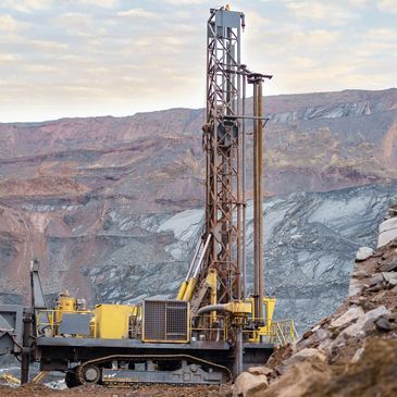
Our geotechnical engineers and geologists have extensive experience in planning and executing site investigations. It is imperative to obtain an understanding of the physical properties of soil earthworks and foundations, through surface and subsurface exploration prior to commencing your project.
The methods we use to obtain this informa
Our geotechnical engineers and geologists have extensive experience in planning and executing site investigations. It is imperative to obtain an understanding of the physical properties of soil earthworks and foundations, through surface and subsurface exploration prior to commencing your project.
The methods we use to obtain this information include drilling, soil sampling, laboratory testing, test pitting, trenching, boring, in situ tests and seismic investigations.
Proof Roling of Geotechnical Design
Proof Roling of Geotechnical Design
Proof Roling of Geotechnical Design
As projects become more complex, independent review and proof engineering of designs and confirmation of technical accuracy and competence becomes more important to the success of projects. Working collaboratively, we draw on our past detailed design, temporary works and complex geotechnical experience, always seeking to develop best for project outcomes.
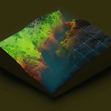
Ground Modelling
Proof Roling of Geotechnical Design
Ground Modelling
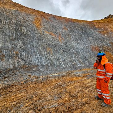
One of the primary and fundamental components of this investigation process is geological mapping. This is an exercise that fundamentally involves the identification of landforms and geomorphological processes, coupled with the collection of geological, structural and rock mass data from exposures that may include pit faces, road cuttin
One of the primary and fundamental components of this investigation process is geological mapping. This is an exercise that fundamentally involves the identification of landforms and geomorphological processes, coupled with the collection of geological, structural and rock mass data from exposures that may include pit faces, road cuttings or natural outcrops.
The purpose of geological mapping is to develop an understanding of the site specific geological conditions including potential geo-hazards, provide a preliminary assessment of the likely reaction of the soil and rock to the proposed structures, and to facilitate optimum design of the foundations, pavements and earthworks required for the proposed construction.
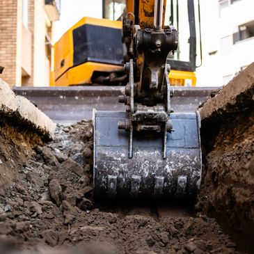
Earthwork
Soil and rock slope analysis
Ground Modelling
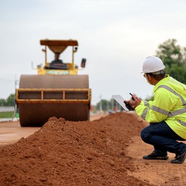
Collectively, we have been responsible for the design, management and certification of millions of cubic metres of the compacted earthfill associated with the large land and civil infrastructure development projects.
Material Identification
Compaction Techniques
Material testing
Dewatering
Fill Certification
Site Classiciation
Soil and rock slope analysis
Soil and rock slope analysis
Soil and rock slope analysis
Geotechnical team combine geological and engineering expertise, and significant slope stability experience, to develop relevant ground models, determine critical site specific parameters, complete appropriate engineering analysis of slope stability, assess associated Factors of Safety and identify risk management issues. In many cases th
Geotechnical team combine geological and engineering expertise, and significant slope stability experience, to develop relevant ground models, determine critical site specific parameters, complete appropriate engineering analysis of slope stability, assess associated Factors of Safety and identify risk management issues. In many cases the Geohydro design team extend the geotechnical scope of work to also include the identification, design and specification of optimised slope remediation, stabilisation and protection measures as well as compatible slope monitoring systems.
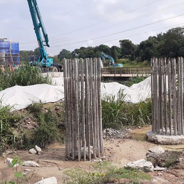
pile testing
Soil and rock slope analysis
Soil and rock slope analysis
Geohydro have extensive experience in the design and testing of piles using all the above methods. We are able to provide engineering services to supervise testing and carry out interpretation using all of the above methods. Our independence from the piling contractor can often be valuable for the testing of piles, particularly for public projects where independent testing is a requirement.

Ground improvement
Ground improvement
Ground improvement
The geological environments in which our team have worked demand the application of various ground improvement techniques to stabilise, strengthen or stiffen the landform to facilitate earthworks programs, building or infrastructure developments.
foundation
Ground improvement
Ground improvement
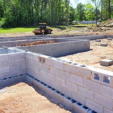
We have extensive experience in designing or providing recommended geotechnical design parameters for a range of shallow and deep foundations. Our understanding of soil-structure interactions for a range of applications from bridges and jetties to high rise buildings and major infrastructure assets is a key attribute.
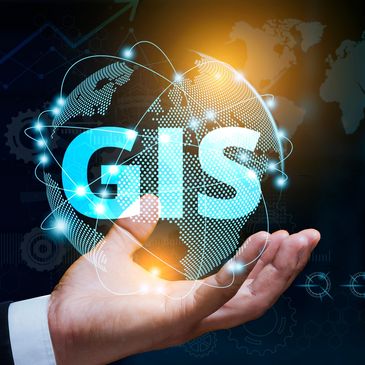
GIS
Ground improvement
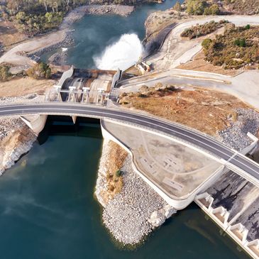
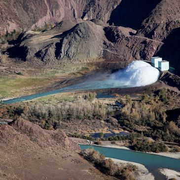
Hydrology studies
High-precision mapping, terrain modelling, geospatial data interpretation, and risk zoning.
Hydrology studies
hydrogeological studies
Hydrology studies
We offer comprehensive hydrological and flood modelling services to assess surface water behavior and manage flood risks in both urban and rural environments. Our team uses advanced modelling tools and GIS integration to deliver accurate, site-specific solutions that support safe and compliant development.
Our services include:
- Catchment h
We offer comprehensive hydrological and flood modelling services to assess surface water behavior and manage flood risks in both urban and rural environments. Our team uses advanced modelling tools and GIS integration to deliver accurate, site-specific solutions that support safe and compliant development.
Our services include:
- Catchment hydrology and runoff analysis
- Floodplain mapping and hydraulic modelling (1D/2D)
- Rainfall-runoff modelling using industry-standard software (e.g., HEC-HMS, TUFLOW)
- Stormwater impact assessments
- Flood risk assessments for planning and development approvals
- Water-sensitive urban design (WSUD) support
- Design of drainage and mitigation infrastructure
hydrogeological studies
hydrogeological studies
hydrogeological studies
Our hydrogeological assessments provide critical insight into groundwater systems to support sustainable water management and informed site development. We evaluate aquifer characteristics, groundwater movement, and potential environmental impacts across various project types.
Our services include:
- Groundwater investigations and monitoring
- Aquifer testing and permeability analysis
- Bore construction supervision and logging
- Groundwater modelling and flow analysis
- Contaminant transport studies
- Dewatering assessments and management plans
- Groundwater impact assessments for development applications
We use a combination of field data, GIS, and modelling tools to deliver accurate, site-specific hydrogeological solutions aligned with regulatory requirements.
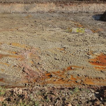
environmental studies
hydrogeological studies
hydrogeological studies
We provide reliable environmental consulting services to help clients identify, assess, and manage environmental risks associated with land development and infrastructure projects. Our work supports compliance with environmental regulations and promotes sustainable project outcomes.
Our services include:
- Preliminary and Detailed Site Inves
We provide reliable environmental consulting services to help clients identify, assess, and manage environmental risks associated with land development and infrastructure projects. Our work supports compliance with environmental regulations and promotes sustainable project outcomes.
Our services include:
- Preliminary and Detailed Site Investigations (PSI & DSI)
- Acid Sulfate Soil assessments and management
- Soil and groundwater contamination assessments
- Waste classification and disposal advice
- Remediation planning and validation
- Groundwater and soil vapour monitoring
- Environmental due diligence for property transactions
Our environmental team combines field expertise with analytical precision to deliver timely, cost-effective solutions tailored to project and regulatory needs.